Pawtuxet Village Historic Homes & Buildings Historic Homes & Buildings |
|
The following material has been adapted from a
manuscript found in the papers of Hazel Wade Kennedy
in folder entitled "Colonial
Ladies Historical Exhibit-1972". Hazel Wade Kennedy was a
well known historian of Pawtuxet Village, a direct
descendant of Rhode Island founder Roger Williams, a
Charter Member of the Gaspee Days Committee, and its
first organizational historian. It should be
noted that much of Hazel Kennedy's material comes from
a noted local historian of a previous generation,
Horace Belcher. The Colonial Ladies was an
subgroup of the Gaspee Days Committee that traveled
throughout the state of Rhode Island in the early
1970's dressed in colonial garb and discussing the
importance of the Gaspee Affair in the founding of our
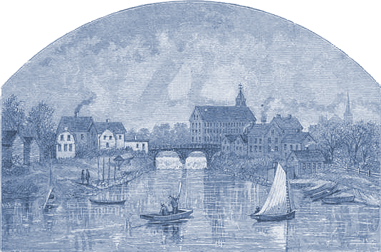
nation. New material was derived from cross referencing the three commercial advertisers' maps of 1862, 1870 and 1890 presented on this page. The text has been supplemented by material adapted from Hazel Kennedy's "Fragments of Time in Pawtuxet" (1986) and "The Walking Tour of Historic Pawtuxet Village" by Hazel Wade Kennedy and Scott Avedisian, Warwick Economic Development Department/Tourism Office, 1999. Used with permission. Only from the original publication will you get a tour arranged into a walking order. The presentation here is alphabetized by street name The text has also been supplemented by material found in "150 Years of Harmony" by Milton R. MacIntosh,(1955), Pawtuxet Village: National Historic District ~ The Cranston Side, by Janet Hudon Hartman, (2008), by various articles that have appeared in The Bridge, the newspaper of the Pawtuxet Village Association, and by the 1973 survey of structures located within the Pawtuxet Village Historic District. Only those stuctures that appear with Plat-Lot numbers in the listing below are included in the 1973 survey. Direct access to the Plat-Lot maps is available on the Warwick side at http://warwickri.gov. Discussions about structures no longer in existence appear in italics. An excellent photo reference is "Images of America: Pawtuxet, Rhode Island", by Henry A. L. Brown & Don D'Amato. |
|
Advertiser's Map of
Pawtuxet Village c1890
Advertiser's
maps such as these (above and below), and even
histories published in book form in
the late 19th century. were
often commercialized ventures. The mapmaker or
historian would sell space on or in the publication to
citizens with enough money to have their residence
depicted on the corner of the map, or have their
biography appear in the history book. While such
lack of objectiveness astounds true historians, these
publications are still useful to obtain background and
location information. |
 |
|
Above:
Map of Pawtuxet, RI, 1890 produced by C. H. Bailey
& Co, drawn by W. A. Saiger. The above is a
scanned image old print which appears in "150
Years of Harmony" by Milton R. MacIntosh, (1955) a
history of the old Harmony Masonic Lodge located in
Pawtuxet Village. The numbers printed on the map
as published in the book corresponded to various
Masonic-related sites, but are still useful as
re-indexed below:
1. Post Road and Bank Street 2. The H. Nelson Slocum House (30-32 Post Road) 3. Christopher Rhodes House (23-25 Post Road) 4. William Rhodes House (141 Post Road) 5. The Anthony Aborn Tavern (now demolished from Bridge Street) 6. The Dr. Comfort Carpenter House (moved house to now 2139 Broad Street) 7. The Ephraim Bowen House (130 Fair Street) 8. The (Old) Pawtuxet Baptist Church (2157 Broad Street) 9. The Pawtuxet Bank (40 Post Road) 10. The Remington Arnold House (12 Bridge Street) 11. Pawtuxet Rangers Armory (59 Remington Street) 12. Site of what is now Trinity [Episcopal] Church (139 Ocean Avenue). This map above, complete with close-up depictions of various residencies and stores was reprinted by the Pawtuxet Village Association in 2006, and is available for purchase for $10 at Twice Told Tales on Broad Street. |
| Advertiser's Maps of Pawtuxet Village c1870 and
c1862 |
|
 |
 |
| Left: 1870 Advertiser's Map of Pawtuxet. Click to enlarge detail. | Right: 1862 Advertiser's Map of Pawtuxet (image of poor quality) |
| List of Homeowners as Listed on 1870 Advertiser's Map (as Best Deciphered) |
| Main
Street (now Broad Street), West Side, North to South, Cranston
|
Main
Street (now Broad Street) East Side, North to South, Cranston
|
Commercial
Street, Cranston
|
Ocean
Avenue, Cranston
|
<< Cranston List
of Homeowners
as Listed on 1870 Advertiser's Map (as Best Deciphered)  Warwick
>>
|
Main
Street (now Post Road), North Side, East to West, Warwick
|
|
Main Street (now Post
Road),
South Side, East to West, Warwick
|
Fair
Street, Warwick
|
Canonchet
Avenue, Warwick, (approx)
Remington Street, Warwick
|
| OLD HOUSES AND NOTABLE PLACESCRANSTON:
(Jump
to Warwick) |
| ABORN STREET: Presumably named after
Samuel Aborn, who moved from Swansea, MA to Pawtuxet in
1722 and bought land at this location from Peleg
Rhodes. A house was constructed in 1740 sandwiched
between Aborn Street and Bridge Street that, when passed
on to his son Anthony, became the Aborn Tavern
(discussed below) on Bridge Street. At the foot of
Aborn Street, Samuel Greene and Ed Johnson ran fish
markets in the 19th century. SOLOMON THORNTON HOUSE (No longer in existence) stood at the foot of Aborn Street and was built in the early 1800's. Captain Solomon Thornton was a mariner who died in 1888. The second family to live here was the Battey's. The last member of this family was George, who lived alone until his death in 1901. For many years, on sunny days in summer and spring, this old man with silvery white hair and beard, would sit in an old fashioned high back chair on a box in front of the Pawtuxet Fish Market, located on the west side of Broad Street near the bridge. He seldom spoke, but sat there dozing and day dreaming. When he died his age was given as 68. He looked much older. The story is that shortly after his father's death and interment in the family tomb, across from the Old Greene cemetery, he accidentally got shut in. After spending the night with the dead, his hair was stone white. This experience affected him the rest of his life. 9-11 BAYAMO LANE "Gambrel-roof cottage" probably built by Israel Smith c1770 wood Colonial. Plat-Lot 1-96. This house had been moved in 1898 from an earlier location along West (Fort) Avenue to allow for the construction of Bayamo Lane. Bayamo is a city in Eastern Cuba. See (Pawtuxet) Bridge 34:2, 2008 p16 for story. 12 BRIDGE STREET (1740) Remington Arnold House was erected around a large brick chimney to permit several fireplaces in the house. This house has miraculously survived several hurricanes and floods. Wood Colonial structure. Plat-Lot 1-23. Remington Arnold is said to have been a prominent trader when Pawtuxet was an active seaport. In the 19th Century, a Remington Arnold, Jr. was the customs inspector for Pawtuxet. Bridge Street was, of course, named for the adjoining Pawtuxet Bridge, and it is the most southerly of streets in the Cranston section of Pawtuxet. PAWTUXET ATHLETIC CLUB (1922), A more complete history of the Pawtuxet Athletic Club written by Henry A. L. Brown is available in the fall 2013 The Bridge (40:2) PAWTUXET COVE HOUSE. (No longer in existence) Clambake resort built around 1890 by Albert Slocum on Bridge Street facing the cove. It was a long, open pavilion in the summer and in the winter windows were fitted into the openings. During the early part of the 20th century the Cove House closed and eventually the old building was torn down. ANTHONY ABORN TAVERN. (No longer in existence) The site of this popular tavern was at the foot of Bridge Street, originally only the driveway to the front door of the old inn. Captain Anthony Aborn (c1736-1823) operated a store along the main street of Pawtuxet during the Revolutionary War, and was hired by the State to conduct a salvage operation on the remnants of the HMS Gaspee in 1772, but no artifacts are known to currently exist other than the silver wine goblet that can be seen at the John Brown House. The Aborn Tavern was erected circa 1740 becoming a public tavern in 1798. After Anthony retired in 1814, the operation of the tavern was taken over by his son, Joseph Aborn. During the late 1800's it became a tenement and was demolished in 1954 to create the parking lot for Cameron's Drug Store. Plat-Lot 1-23. BROAD STREET, was the first Pequot Trail, a bridle path used by Native Americans across the colony into Connecticut. This was later named Pawtuxet Road, as it was the road leading from Providence to Pawtuxet. The 1870 map give the name of Main Street throughout both the Cranston and Warwick sides of Pawtuxet Village. During the late 19th Century it became known as Broad Street in Cranston as depicted on the 1890 map.. 2064-2086 BROAD STREET, This is an approximate location of the front gates to of the grand estate and mansion of wealthy industrialist, Orray Taft, who owned this large parcel of land extending from Broad Street all the way back to Stillhouse Cove in the late 19th century. Orray Taft (1793-1865) was the owner of the Wauregan Cotton Mill, president of Peoples' Savings Bank, president of the Worcester Railroad, and owner of several whaling ships sailing out of New Bedford. He was known to travel frequently to Southern plantations to buy cotton for his mills, and was an ardent anti-abolishionist. Taft purchased the 35 acre tract in 1860 that had previously been the location of the Brattle Farm. In the 1890 map of Pawtuxet Village, the home was owned by his son, Edward P. Taft. The estate was parcelled off beginning in 1904 and developed in to a neighborhood of houses that set a fine example of early 20th Century suburbia. All of the original buildings and lanscaping of the estate have disappeared, save for a former caretaker's cottage situated at 2064 Broad Street. The entire location of the Taft estate, bounded by Broad Street, Circuit Drive, Narragansett Boulevard, and Winsdor Road, has recently (2003) been designated a National Historic Register district, and directly adjoins the northern border of the Pawtuxet Village historic district. 2139 BROAD STREET, (c1760) Dr. Comfort A. Carpenter House. This was the home of the village doctor, Comfort Carpenter (1763-1830) who lived it it between 1811 and 1830. The attached ell was where the doctor compounded medicines from herbs, grinding them by hand with mortar and pestle. After he (or she) died in 1830, it was passed on to descendants. In 1897 the house became the property of Captain Thomas Gardiner, who had commanded a company of black soldiers that distinguished themselves during the Civil War. Wood Colonial. It has recently undergone an extensive historic renovation under the auspices of the Law Firm of Robio & Brown.. Plat-Lot 1-9. See (Pawtuxet) Bridge 35:1, 2009 p8 for story. 2144 BROAD STREET, (1894) "Edward P. Taft House". Large 2½ story with tower, summer home of industrialist Edward P. Taft built on the roaming estate of his father Orray Taft (see above). Edward P. Taft was owner of the Taftville Cotton Mills, later the Ponemah Mills that dominated Norwich, CT industrial scene in the late 19th Century. Note that Pawtuxet Village: National Historic District ~ The Cranston Side, by Janet Hudon Hartman, 2008 relates this address as being, instead, the home of Huldah F. Chace built in 1892 2154 BROAD STREET, (c1740) Elisha Smith House. Elisha Smith (1777-1832) was an original stockholder of the Pawtuxet Bank in 1815. He and his other brothers, Remington and Simeon Smith, each had houses located along this block of Broad Street. Elisha Smith's house is reputed to be the oldest house still extant on Broad Street per Samuel T. Remington in notes by Horace Belcher (see Warwick City Tribune Oct 13, 1934). Wood Colonial. Plat-Lot 1-328 2157 BROAD STREET, (1895) PAWTUXET BAPTIST CHURCH. In 1764 Peleg Arnold donated a piece of land for religious purposes and the following year Abraham Sheldon gave an adjoining lot. The present church stands on those two lots with only a slight change of boundary. In 1774 the General Assembly granted permission for the Pawtuxet Baptists to hold a lottery to raise £500, lawful money to buy a lot and erect a parsonage. Anthony Aborn headed a committee of four men to run the lottery. The money was raised and a parsonage built at 30 Fair Street. This would appear to indicate there had been a building previous to that time used as a church. No records appear to exist as to the building of the first edifice, only the statement "having been erected in 1805" (and was torn down in 1855). The second church was built in 1859 in Greek Revival fashion. In 1895, with the widening of Broad Street, the second edifice was demolished and the present (3rd) church built in 1895. Designed by Frank Angell, Late Victorian, wood structure. Plat-Lot 1-11. A more complete history of the Pawtuxet Baptist Church written by Janet Hartman is available in the fall 2013 The Bridge (40:2) 2159 BROAD STREET, (No longer in existence) Swift-McNutt Building, site of a home, building supply store, restaurant, and electronics repair shop before being demolished in the mid 20th Century. 2178 BROAD STREET, (No longer in existence) Watson's Grill & Pastry Bakery took over the old Sheldon Home (2 story wood Colonial) prior it being demolished for a gas station, and now the parking lot for Lindsay's Market. 2180 BROAD STREET, (1893) Lindsay's Market stands at the corner of Broad and George Streets. Built for the home of the Odd Fellows Mount Vernon Lodge No.50. The third floor window in the front was part of a Moorish Arch over which there used to be three links emblematic of Odd Fellowship. Lindsay's Market has been a fixture of the Village since the mid-twentieth century when it was opened by Andrew Lindsay, and subsequently operated by his sons Bill and Jack. Includes address numbers 2178-2184 Broad Street. Late Victorian, wood, now vinyl-sided. Plat-Lot 1-47 2185-2189 BROAD STREET, (No longer in existence) The approximate original house location of Civil War hero Elisha Hunt Rhodes, now demolished, and presently the location of Citizens Bank 2190 BROAD STREET, the original location of the Hayward House, wood Colonial, demolished in the mid 20th century to construct Upham's paint & hardware store, now the mall housing L'Attitude's , Water's Edge, and other businesses. Joseph B. Hayward was a local realtor who owned many buildings in 20th century Pawtuxet. 2195 BROAD STREET, now Basta Restaurant, is the original location of E. S. Arnold General Store, post office, and garage back in the 1890's to mid 20th Century. Moved building may be still extant at 62 Tucker Aveneue. 2201 BROAD STREET, now the location of Village Cleansers, it was the site of the now torn down H. J. Badmington Bakery of the 19th Century. 2206 BROAD STREET, Pawtuxet drug store was opened in the spring of 1889 by Walter E. Watson in a small building at the corner of Broad and Bridge Streets. It was the only pharmacy between the Pawtuxet Bridge and Thurbers Avenue and was later rebuilt in the 20th Century as the Pawtuxet Pharmacy, now known as Cameron's. 2210-2218 BROAD STREET, now BobbyPins to Dear Hearts Ice Cream et al, this was the original location for the Sam R. Green Fish Market and Restaurant, succeeded by the J. Steven's Fish Market,. This Hayward block was heavily damaged by fire in 1892, and in 1924 was operated at Wilbour's Pawtuxet Public Market. PELEG RHODES HOUSE. (No longer in existence) The site of this beautiful old house was at the corner of Aborn and Broad Streets. It was demolished in 1954 to make a parking lot. Peleg, youngest son of Zachary Rhodes, built the southerly end in c1673-1678 as a small one-story house. Twelve years later it was enlarged and in 1878 remodeled again after it purchased by Joseph Haywood, a descendent of Peleg. The cellar of the old house contained a deep well from which water was drawn. This was the site for one of two cannon placements during the Dorr Rebellion. PAWTUXET TEXTILE MILL (Cranston End), (No longer in existence) Around 1810 a large three-story textile mill stood at the Cranston end of the Pawtuxet Bridge on Broad Street, extending well over the banks of the river. It was first built by Christopher and William Rhodes and used over the years for a variety of purposes by several owners, including the Brown & Ives, American Wood Paper Company, Pierce-Stafford, and the City of Providence which, at the time, got its water supply from the Pawtuxet River. On January 25, 1875 the mill burned to the ground putting 60 workers out of their jobs. This was the large 3-story factory seen on the Cranston side of the bridge in the 1870 arched drawing of Pawtuxet that graces our main web page. PAWTUXET RIVER DAM. The name Pawtuxet comes from the Narragansett Indian word for "Little Falls' and relates to the natural stone rapids that flowed just upstream and adjacent to where the Pawtuxet Bridge now stands. Totowamscut is the Narragansett word for 'bridge", and Native Americans often used this area of shallows as stepping stones to cross over the river to the opposite side. In the late 19th Century the Providence County Water Authority took control of the Pawtuxet River and used it as its main source of water. An elaborate water pumping station was built, just upstream on the Cranston side, and a wooden dam created just shy of the bridge in order to raise the water level. A concrete dam (or spillway) replaced the older wooden dam in the 1920s. Efforts are now underway to modify the dam by creating a fish ladder so that native fish can travel upstream to spawn. PAWTUXET BRIDGE. The earliest bridge across the Pawtuxet River was a rope bridge used in the seventeenth century. The first small wooden bridge was built around 1711 and was located close to the falls where its abutments got the full force of the river as well as the tide in the Pawtuxet Cove. A second bridge was contructed c1750 with funds raised by a lottery. It frequently required repairs and was carried away in the spring floods of 1771, rebuilt in 1772, and again washed away in 1784. A new covered bridge was constructed yet again and referred to as the 'Colonel Bowen Bridge' in honor of our local Gaspee burner and Revolutionary War leader. Circa 1810 a new stone bridge was built, and in 1884 a twin arch span was erected of stone with wrought iron guard-rails. In March 1886 the river overflowed its banks and the force and volume of water that poured over the dam filled the arches, built of stone and moved the Warwick end slightly on its abutments. The bridge was widened in 1932 with reinforced concrete construction faced with stone masonry. Repairs to this (the 9th) bridge continue to be the joint responsibility of the Cities of Cranston and Warwick, and it marks the unity of the two sections of Pawtuxet Village. A more complete history of the Pawtuxet bridges written by Henry A. L. Brown is available in the fall 2013 The Bridge (40:2) In the early twentieth century the Pawtuxet Bridge and the rocks in the Pawtuxet Falls were frequently the target for graffiti artists. To counteract this, the Pawtuxet Old Home and Improvement Association planted quick-growing vines to grow over the rocks and walls on each side of the falls. In 1909 there was apparently a rather obnoxious "whiskey bottle" billboard disfiguring the view of Pawtuxet Cove as seen from the Pawtuxet Bridge. These people from Pawtuxet fought a long and hard battle to have such billboards removed or covered up with trees, and the battle continues to this day under the auspices of the Pawtuxet Village Association. PAWTUXET MILLS (Warwick end). (No longer in existence) Soon after 1638 Stephen Arnold and Zachariah Rhodes built a grist mill at the Warwick end of the early Pawtuxet Bridge. Ships would bring corn from farms around Providence to Pawtuxet to be ground into corn meal. In the early 1800s this grist mill was replaced by a small gable-roofed yarn mill owned by Pawtuxet natives Christopher and William Rhodes until fire heavily damaged the mill in 1859, but in the 1890 map drawing above, there appears to be another 3 story factory on this site. It does not appear in the 1870 drawing, so this factory must have been built after that time. In the latter part of the nineteeth century, the Tillinghast & Watson blacksmith and carriage shop dominated the Warwick side of the Pawtuxet Bridge at the site of what is now Hunter's Garage. PAWTUXET CANOE CLUBS: (No longer in existence) Much as kayaking is a popular sport today, river canoeing was popular in the early 20th century. Rhodes began renting canoes at their venue in the late 19th century; the idyllic setting made for athleticism or romance as the occasion warranted. There quickly formed three private clubs, all nearby each other along the Pawtuxet River and just upstream from Rhodes: The Pawtuxet Canoe Club, the Swastika Canoe Club, and the Sackatchewam Canoe Club. Competitions were occasionally fierce. The Pawtuxet Canoe Club was lost during the 1915 fire that destroyed the original Rhodes-on-the-Pawtuxet, and the others are also long gone. For the record, the Swastika Canoe Club had no relation whatsoever to the Nazi Party; the swastika was long before considered a sacred symbol in Eastern philosophies. 10 COMMERCIAL STREET c1870 late Victorian, wood structure with Mansard roof. Plat-Lot 1-70 This house was the residence of Charles G. Bloomer, whose jewelry factory was next door. during the late 19th and early 20th century. According to Pawtuxet Village: National Historic District ~ The Cranston Side, by Janet Hudon Hartman, 2008, the house originally stood at the corner of Ocean Avenue, but was turned and moved one lot south onto Commercial Street. C. G. BLOOMER & SONS, (No longer in existence). This jewelry factory was originally built in 1878, destroyed by a great fire in 1888, then rebuilt. The Bloomer factory dominated the 1890 map of Pawtuxet Village at Commercial Street, and was still an existing structure c1950. The main factory was a two-story mansard roof and gabled wood building that appears much larger on the map drawings than appeared in real life. C.G. Bloomer's Sons occupied the lower floor of the factory, while another jewelry manufacturing firm, S. K. Merrill, occupied the top floor, each firm employing about 50 workers. Charles G. Bloomer's (1827-1913) residence was sited next door near the corner of Commercial Street and Ocean Avenue. Further East on the block were a series of 7 or 8 "Bloomer Cottages" occupying the entire Southeast corner of Fort Avenue with Ocean Avenue, and which presumably housed mill workers from the Bloomer factory. Some of these cottages have been since moved over to Sheldon Street. Open roofed "Bloomer trolleys" also brought workers to the factory during its heyday. Charles Bloomer was a prominent man about town in the late 19th Century, being a member of the City Council and actively involved as Commodore in the funding and building of the RI Yacht Club. He also owned the grand steam yacht, Mignon, that was its flagship. We can assume that Commercial Street was so named because of the commercial jewelry factories that were at one time located here. 34 COMMERCIAL STREET, (c1835-1891) Pawtuxet Volunteer Fire Station (later a Salvation Army Emergency Service Vehicle Center) stands at the corner of Commercial and Sheldon Streets. Partly in response to devastating mill fires in 1875 and 1888, the company was organized on February 11, 1891 and in November land was purchased for the construction of a station. Plans were also underway at this time to build a larger school house on Commercial Street. The old wooden original school was built circa 1835-40, in Greek revival fashion, and used floorboards that were salvaged from sugar and molasses shipping crates. Local Civil War hero Elisha Hunt Rhodes, recalled that during the summer, the heat would melt the molasses, sticking shoes to floor, and attracting insects. To save the one room school from destruction it was purchased by the Pawtuxet Volunteers for $50 and moved across the street to the land the firemen owned. The school building was raised and a station built beneath it in 1897. A cinderblock hallway and stairs were later added to the end. Plat-Lot 1-83. A more complete history of the Pawtuxet Volunteer Fire Department written by Fred Holst is available in the fall 2013 The Bridge (40:2) FORT AVENUE, running along Pawtuxet Neck got its name from the Revolutionary War fort that stood on a high bluff at the head of today's Sheldon Street. The fort was manned by the Pawtuxet Rangers militia, and consisted of a guard house and two 18 pound cannon. (It's important to note here that it was the ammunition that weighed 18 pounds, not the cannon.) Edward Field presents lists of men who served at the fort in his 1896 work Revolutionary Defences in Rhode Island (p85 and on). The path to the fort was down Still House Lane (now Ocean Avenue) with a turn onto Fort Avenue. The peninsula itself has had various names through the years: Long Neck, Fort Neck, Cranston Neck and (currently) Pawtuxet Neck. Fort Avenue itself was listed as West Street on the 1870 Advertiser's Map. 6 FORT AVENUE "Charles Brown House", c1921 modern - Colonial revival, brick. This estate house is guarded by two stone lions at the gate, and is located at the site of the earlier, John Austin House. In 1927, the house was purchased by Majestic Theater owner, Alton C. Emery (1885-1941) Plat-Lot 1-363 7 FORT AVENUE "Austin Carriage House," 1896 late Victorian, brick, converted to condominiums in the 1980s. Plat-Lot 1-77 John Austin at one time owned a large mansion at this and the adjoining location. He hosted the first services of the newly organized Trinity Episcopal Church at his home in 1883. John Austin, and later his son, Arthur, owned a massive 100 foot steam yacht, Corento, that was berthed in Pawtuxet Cove. This was the same John Austin who operated the largest gold and silver refining firm in Rhode Island, and who also served as president of Citizens Bank in the late 19th Century. 22 FORT AVENUE "George West House," 1892(?) late Victorian - Colonial Revival, brick. Plat-Lot 1-117. This address was previously the location of a grand mansion built by Arthur E. Austin (1884-1941) and destroyed by fire in 1926. Like his father, Arthur Austin was in the gold refining business, became a President of Citizens Bank, and a Commodore at the RI Yacht Club. 23 FORT AVENUE "W. Bogman House," c.1850 early Victorian - Mansard, wood. Plat-Lot 1-79 32-34 FORT AVENUE. "Robert E. Smith House", c1898, 1 and 1/2 story, Colonial revival, wood, Plat 1, Lot 115. The previous site of 'Chauncey Stone's House Source: Pawtuxet Village: National Historic District ~ The Cranston Side, by Janet Hudon Hartman, 2008. Robert E. Smith was a coal magnate in Providence. Previously owned by John W. Coggeshall, who was an executive with the Riverside Mills woolen cloth manufacturers. 34 FORT AVENUE 1910 late Victorian-Colonial Revival, wood. Plat-Lot 1-115. . 35-37 FORT AVENUE "A. Smith House," c.1870 early Victorian, wood. Plat-Lot 1-80 36 FORT AVENUE "Clark H. Johnson House" c1896 late Victorian - Queen Anne, wood. Plat-Lot 1-111 Land was 3 lots purchased from Charles A. Mathews, includes Carriage House c1890s. Source: Pawtuxet Village: National Historic District ~ The Cranston Side, by Janet Hudon Hartman, 2008. 50 FORT AVENUE "William Chambers House," 1895 late Victorian - Shingle, 2 and 1/2 story. wood. Plat-Lot 1-109 REVOLUTIONARY WAR FORT ON PAWTUXET NECK (No longer in existence) on Fort Avenue. The fort was built on October 17, 1775 on land owned by Captain Remington of Pawtuxet. It was built from shore to shore, and from the high bluff to the water of the bay was almost a straight drop and made an ideal spot for defense. Within the fort was a guard house, twelve feet by eight feet. It had a battery of two 18-pound guns capable of firing an iron ball for a range of reaching the East Providence shore. The fort was erected to protect the surrounding country from the enemy. Here served the Pawtuxet Rangers. The fort stood in the vicinity of what is known today as 52 Fort Avenue. 53 FORT AVENUE "Susan Hart House," 1902 late Victorian, wood. Plat-Lot 1-87 Pawtuxet Village: National Historic District ~ The Cranston Side, by Janet Hudon Hartman, 2008, postulates that this house may have been the original "William Chambers House" of 50 Fort Avenue later moved to this site. Now a duplex condominium. 62 FORT AVENUE "Allen Greene House," 1898 late Victorian - Queen Anne, wood with octagonal pavilion. Plat-Lot 1-105 69 FORT AVENUE, (c1865) The Barracks House. After the Revolutionary War fort was no longer in use, the timbers from the guard house (c1775) were used to build the dwelling of Captain Alonzo W. Crandall, better known as "Lon". He was a Pawtuxet boat builder and had a boat yard just below his home. The front part is the old Barracks House, believed to have been erected circa 1865. Colonial, wood. Plat-Lot 1-90 72 FORT AVENUE "Eudora Benyon Double House," 1874 late Victorian - Queen Anne, wood. Plat-Lot 1-103 Includes '"Carriage House" 19th Century., late Victorian - Oueen Anne, wood. 73 FORT AVENUE "Edward Williams House," 1897 late Victorian - Oueen Anne, wood. Plat-Lot 1-90 74 FORT AVENUE "V. Chace House." c1840 Greek Rival, wood. Plat-Lot 1-102 75 FORT AVENUE "Sister House," c1900 late Victorian • Queen Anne, wood. Plat-Lot 1-258 Less preserved in it's period detail than its 'sister' 77 FORT AVENUE "Isaac Golden House", also a "Sister House" c1900 late Victorian - Queen Anne, wood. This is a twin house to 75 Fort Avenue, both said to have been built by a sea merchant for his ship's captain and first mate. The house was originally designed to focus on Fort Avenue, deliberately ignoring the noise and smells of the working marina to the rear, cove side. It has now been remodeled with an excellent overlook to Pawtuxet Cove. Plat-Lot 1-259 89 FORT AVENUE "Robert E. Thornton House." 1896 late Victorian - Queen Anne, wood. Plat-Lot 1-93 94 FORT AVENUE "Charles R. Day House," 1892 late Victorian - wood, Shingle. Plat-Lot 1-94 99 FORT AVENUE "Abner Hart House," 1892 late Victorian - Queen Anne, wood. Plat-Lot 1-143 105 FORT AVENUE "Rosa Stone House," 1904 late Victorian, wood, altered. Plat-Lot 1-144 109 FORT AVENUE "Martin Dewing House," 1890 late Victorian, wood. Plat-Lot 1-147 108 FORT AVENUE "Sheldon Brown House/James H. Field House," 1870 late Victorian - bracketed, wood. Sheldon Brown was a mechanic and had a relatively simple house built on this site around 1870 It was next acquired by James H. Field, 2nd, who developed the house and enclosed the original open porches. Plat-Lot 1-145 112-114 FORT AVENUE "Double House," c.1874 late Victorian, wood. Plat-Lot 1-148 GEORGE STREET was named before the Revolutionary War. It was allowed to retain its name even though it originally honored King George III of Great Britain during whose reign the American colonists won, by force-of-arms, their independence. 21 GEORGE STREET. Built before the Revolutionary War c1760 on the site of today's Lindsay's Market. It was moved to its present location in 1893 to permit the building of the Odd-Fellows Hall, now Lindsay's. Wood Colonial. Plat-Lot 1-389. KNEELAND STREET. This street was named after local attorney, Cassius Kneeland, who had a large house here and also owned the nearby canoeing club that was located at the end of Kneeland Street on the Pawtuxet River c1895. OCEAN AVENUE, originally named Stillhouse Lane, (sometimes referred to as Distill House Lane). In its first days the lane led only to the old still house kept by Joseph Rhodes during the Revolutionary War. It stood on the corner of the bluff overlooking Stillhouse Cove to the north and Pawtuxet Neck to the south. Stillhouse Cove is found on maps dated long before the American Revolution, and was laid out c1744. Stillhouse Lane was the first approach opened to the Neck. Later it was named Carey Lane and around 1850, when Sheldon Street was opened to the head of the Pawtuxet Cove, the name changed to Ocean Avenue. At the foot of this street Lt. Dudingston, of the British schooner, Gaspee, was brought ashore at Stillhouse Cove on the night of June 10, 1772. He had been wounded during the conflict aboard the Gaspee and was carried up Stillhouse Lane to the home of Joseph Rhodes, where he remained until his wounds were healed enough that he could recuperate in Newport. Horace Belcher claimed Joseph Rhodes was a known Tory sympathizer. A monument at the edge of the Cove attests to this historical site. 1 OCEAN AVENUE, (1956) Rhode Island Yacht Club at the foot of Ocean Avenue, is the second oldest in this country. It was erected in 1875-77 under the financial oversight of local industrialist, Charles Bloomer on the site of what had been Orray Taft's Wharf . The first yacht club swept from its pier and toppled into the bay by an unnamed hurricane on September 21, 1938. A sturdier club house was built in 1940, but along came hurricane Carol in 1954 and left only a cradle of spiles. Today's modern structure was erected in 1956. A more complete history of the the RIYC is available in the fall 2013 The Bridge (40:2) MASONIC TEMPLE (no longer in existence) stood at the corner of Ocean Avenue and Circuit Drive on land once occupied by Mr. Joseph Rhodes's distillery during the Revolutionary War days. It was here Mr. Rhodes was found drowned in one of his large distilling tanks, a possible victim of his own product. Harmony Lodge held its first meeting in the new Temple on November 27, 1906. In 1942 they purchased the (now demolished) Castle on Narragansett Boulevard and left Pawtuxet where they had met for 137 years. Although related Masonic organizations, the Shriners and the Scottish Rite Center both now occupy large pieces of Pawtuxet, the original Harmony Masonic Lodge is located on Reservoir Avenue in Cranston. A more complete history of the Harmony Lodge written by Milton MacIntosh and Paule Liese is available in the fall 2013 The Bridge (40:2) 90 & 92 OCEAN AVENUE (c1887). These 2 adjacent homes are examples of 'Bloomer Cottages'. They had been built for local industrialist Charles G. Bloomer to house his factory employees, or possibly use them as investment summer vacation rentals. 108 OCEAN AVENUE. (c1881) "William Bloomer House", Willaim Bloomer (1850--1921), one of three sons of local industrialist Charles G. Bloomer. Source: Pawtuxet Village: National Historic District ~ The Cranston Side, by Janet Hudon Hartman, 2008. 139 OCEAN AVENUE, (1910) Trinity Episcopal Church was organized in 1883 and met for twenty-seven years in a small chapel at the corner of Commercial and Sheldon Streets. In 1910 this beautiful stone edifice was erected on Ocean Avenue on the property abutting the old Harmony Masonic Lodge. Noted mid-20th century Pawtuxet historian Horace Belcher claims that the well from which Joseph Rhodes drew water for his distilling operation was still present just to the west of the church edifice. 144 OCEAN AVENUE "Built by W.C. Rhodes," 1857 Greek Revival, wood. Plat-Lot 1-60 WATERMAN HOUSE (No longer in existence) was at the corner of Ocean Avenue and Fort Avenue. It was the first house built on Long Neck and the only brick house in the old village. It was built in two sections. The north part was built by Stukeley Smith around 1745 of bricks from the kiln on nearby Stillhouse Cove. His daughter, Hannah married Rhodes Waterman and he built an addition onto the south end. It was razed in September 1896. 60 RHODES PLACE, (1915) Rhodes-on-the-Pawtuxet. Located on the banks of the Pawtuxet River only a short distance from the Pawtuxet Bridge, this resort for pleasure and recreation was founded in the year 1872 by Thomas H. Rhodes, a native of Cranston. This soon became a reknown family recreation destination, andfeatures included a grand ball room/dance hall, bowling alleys, river canoeing, competition rowing, baseball, lover's lane, and clambakes. On February 15, 1915 a fire broke out and the building burned to the foundation. A larger structure was built and opened to the public in August of the same year. From Maine to California and to the Gulf coast, this summer and winter resort for dancing, bowling and canoeing became universally known. The "Rhodes-on-the-Pawtuxet" Gazebo (at the corner of Rhodes Place and Broad Street) and Rhodes-on-the-Pawtuxet ballroom are separately designated as National Historic Sites and are not actual parts of the Pawtuxet Village Historic District. Two more complete histories of Rhodes-on-the-Pawtuxet written by Ginny Leslie and by Richard Walton are available in the fall 2013 The Bridge (40:2). SEAVIEW AVENUE: Note in reviewing the 1870 Advertiser's Map of Pawtuxet Village, one W. Butler owned at the time the entire southern third of Pawtuxet Neck, as well as most of the facing shore in Warwick from Pawtuxet Village into Warwick Downs extending up to Fair Street. A check of the accompanying directory shows that William Butler was a Providence merchant whose residence was in Pawtuxet. This may be the William Butler who along with W. Clarence Butler incorporated the Butler, Brown & Co. manufacturers and dealers in supplies for the cotton and woollen mills. 11 SEAVIEW AVENUE "Hart Cottage," 1894 (Perhaps earlier) Colonial, wood. Plat-Lot 1-141 12 SEAVIEW AVENUE "Greene Mansion," c.1870 Victorian, brick, altered. Plat-Lot 1-140. The 1890 Map of Pawtuxet depicts the mansion of Mrs. Rufus Greene. 18 SEAVIEW AVENUE "Brownell House," 1879 late Victorian - Queen Anne, wood. Plat-Lot 1-182 Henry Brown indicates that this is actually the "William E. Louttit House" 25 SEAVIEW AVENUE "William E. Loutitt, Jr" House," 1923 Academic/Colonial revival, brick. Plat-Lot 1-377. Operated the Louttit Home Hand Laundry in Providence. 32 SEAVIEW AVENUE "Fred L. Smith House," 1900 late Victorian - Queen Anne/Colonial revival with separate Carriage House along Fort Avenue, wood. Plat-Lot 1-177 33 SEAVIEW AVENUE "Frank W. Angell House," 1888, late Victorian - Shingle, wood. Frank Angell (1851-1943) was a local architect, and a member of the Gould, Angell, & Swift design firm. Plat-Lot 1-149 37 SEAVIEW AVENUE "Alexander House," c.1892 late Victorian-Queen Anne, wood. Plat-Lot 1-150 40 SEAVIEW AVENUE "Susan Sawyer House," 1886 late Victorian - Queen Anne, wood. Built by Thomas Sawyer, Jr, and his wife, Susan. It was later owned by Frank and Louise Turner, and then by their daughter Ethel until her death in 1986. Her will stipulating the destruction of the house and establishment of a city park on the site, was overturned in a much ballyhooed court descision. A subsequent owner created a connecting addition between the house and the garage. The house features breathtaking views across the Providence River to Riverside. New addition connects the House to the Carriage House. Plat-Lot 1-176 42 SEAVIEW AVENUE "Mary Sawyer House," 1889 late Victorian, wood - Alum. clapboards. Plat-Lot 1-175 44 SEAVIEW AVENUE "Callender House," c.1900 late Victorian - Shingle, wood. Plat-Lot 1-174 47 SEAVIEW AVENUE per Pawtuxet Village: National Historic District ~ The Cranston Side, by Janet Hudon Hartman, 2008-- "Robert Pettis Boat House" c1894, designed by Frank Angell and originally located at 82 Sea View Avenue. 52 SEAVIEW AVENUE "Capron House," c.1900 late Victorian - Shingle, wood. Plat-Lot 1-173 54 SEAVIEW AVENUE "J. Clifford Taylor House," c.1870 early Victorian, wood. Plat-Lot 1-172 57 SEAVIEW AVE "George E. Darling House," c.1900 late Victn - Queen Anne, wood. Plat-Lot 1-302 69 SEAVIEW AVE "Canfield Carriage House," c.1900 late Victn - Queen Anne, wood. Plat-Lot 1-158 71 SEAVIEW AVENUE "Canfield Carriage House" c1901, Converted Carriage House with octagonal tower. Plat 1, Lot 158. 72 SEAVIEW AVENUE "Edwin D. Allen-Frances C. Henley House" c1919. Colonial revival, wood, probably designed by Frank Angell. Allen worked for Manchester & Hudson Co. building materials. Plat 1 Lot 168. Source: Pawtuxet Village: National Historic District ~ The Cranston Side, by Janet Hudon Hartman, 2008. Plat 1 Lot 168. 73 SEAVIEW AVENUE "Andrew Harris House," 1884 late Victorian - Queen Anne, wood. Plat-Lot 1-159 75 SEAVIEW AVENUE "Baker House," c.1900 late Victorian, wood. Plat-Lot 1-160 76 SEAVIEW AVENUE "Richard A. and Genevieve W.Canfield House," 1894 late Victorn-Queen Anne-Mansard, wood. Plat-Lot 1-167 Original property included the carriage house at 69 Sea View Avenue. 82 SEAVIEW AVENUE "Robert Pettis House," c.1900 late Victorian - Shingle, wood, believed to be designed by local architect Frank Angell. Plat-Lot 1-260 Robert Pettis was "The Oyster King of Rhode Island". This spot was never a Pettis oyster restaurant; those were located in Providence, but legend tells that the Narragansett/Pawtuxet Indian tribe did have a feasting ground at the Point that was covered with oyster shells in the 17th century. 84 SEAVIEW AVENUE. 2009, Plat 1, Lot 162 Modern house built at tip of Pawtuxet Point. 1870 and 1890 Pawtuxet advertiser maps showed that most of the southern half of Pawtuxet Neck, including Pawtuxet Point was owned by William Butler, who not only had a large wharf on the bay side, but a large tract of land opposite the Neck along, what is now, Narragansett Parkway and Gaspee Plateau. A house was constructed c1912 by Edward M. Fay, (1875-1964) vaudeville impresario and theater owner, and later by Charles Brown, owner of the Narragansett Hotel and the old Providence Opera House on Dorrance Street. The 1938 Hurricane swept away whatever structure existed on the Point. Rebuilding was done, but after Hurricane Carol swept through the structure in 1954 it was severely damaged, unoccupied, and became the object of vandals. Being considered a fire menace it was burned on January 9th, 1960 by the Pawtuxet Volunteer Fire Company. A more modern house was built in 1968, but this was electively demolished and a new stilted house supposedly capable of withstanding hurricanes was constructed in 2009. 85 SHELDON STREET "C. Chase House," c.1865 late Greek revival - early Victorian, wood) 1-81 93, 101, & 103 SHELDON STREET (c1887). These 3 house are all examples of 'Bloomer Cottages', moved from their original location along Ocean Avenue to make room for larger and grander houses to overlook the water. They had been built for local industrialist Charles G. Bloomer to house his factory employees, or possibly use them as investment summer vacation rentals. 139 SHELDON STREET "Ira E. Johnson House," c.1892 late Victorian - Queen Anne, wood) 1-42 140 SHELDON STREET, early Victorian mansard-roofed wood framed house was built facing George Street in 1843. During the 1920's it was turned around to its present location. Plat-Lot 1-44. 143 SHELDON STREET "William C. Rhodes House," Greek Revival, wood, was built on the original George Sheldon plat in 1857 William C. Rhodes was a Pawtuxet house builder, and built this structure as his home. A grave in the nearby Greene Cemetery on Post Road lists William C. Rhodes (1849-1897). Plat-Lot 1-53. 144 SHELDON STREET. Greek revival, wood, also built by William C. Rhodes 146 SHELDON STREET c1880 late Victorian, wood. Plat-Lot 1-45 147 SHELDON STREET "W. Atwood House," c1865 early Victorian, wood. Plat-Lot 1-52 150 SHELDON STREET "Rachel M. Smith House," c1880 late Victorian, wood. Plat-Lot 1-46 21 SPRINGWOOD STREET "E.S. Arnold House," 1804 Federal, brick/wood with Victorian.alterations c1860. Plat-Lot 1-40 E. S. Arnold ran a store and post office on Broad Street for many years. 6 SPRINGWOOD STREET "C.S. Johnson House," c1840 Greek Bevival, wood. Plat-Lot 1-388 STILLHOUSE COVE, It was here at what is now the bayfront of Ocean Avenue that one Joseph Rhodes received shipments of molasses to manufacture rum at his distillery further up the street. On the nighth of June 9/10, 1772 it was here that revolutionaries landed the wounded commander of the HMS Gaspee, Lieutenant William Dudingston, and brought him up to Joseph Rhodes' house to recuperate. TUCKER AVENUE. This was the original site of the Russell Farm which was sold off as housing lots in the early to mid 20th century. Many of the houses here stood originally along Broad Street, which, when widened in 1896, forced the relocation of twenty-three homes. 27 TUCKER AVENUE, c1804. One of the last remaining brick enders, Colonial, wood.. It stood on Broad Street where Tucker Avenue is today. A Dr. Tucker, dentist, lived in the house when Broad Street was widened to accommodate the electric trolleys, and the new street was put in around 1896. The house was moved to its present location and the street named after him. Plat-Lot 1-249. 32-34 TUCKER AVENUE. "Gifford W. Chace House" c1800 Colonial, wood. Gilford William Chace (1812-1897), a resident of Pawtuxet for 85 years and one of the original Forty-Niners, was born in this house when it was located at Peat Brook, then a part of Flint Village in Fall River, Massachusetts. His parents moved to Pawtuxet when he was three months old and took up residence in a house on Bridge Street. Shortly after their arrival, the house at Peat Brook was moved from its foundation, loaded onto a vessel and brought to Pawtuxet and set up again on Broad Street. Here it remained a substantial two-story house until its second relocation to Tucker Avenue, then a new street in the village. Plat-Lot 1-217. 62 TUCKER AVENUE. This house is thought to have been the old E. S. Arnold Building which housed the Post Office and General Store when originally located on Broad Street, Source: Pawtuxet Village: National Historic District ~ The Cranston Side, by Janet Hudon Hartman, 2008. It had been sited originally where Basta's Restaurant is now (2008) at 2195 Broad Street. |
| OLD
HOUSES AND NOTABLE PLACESWARWICK:
(Jump
to Cranston) |
| PAWTUXET PARK. With the trademark white
gazebo and the walkways, Pawtuxet Park has become a
summer favorite for people throughout the area. There
are often band concerts and other activities in the
Park. The Park was acquired by the City of Warwick
through the efforts of former Mayors Eugene McCaffrey
and Joseph Walsh. Old photos indicate that Pawtuxet Park
sits atop what was once the boat storage yard for the
Aspray Boat House. A more complete history of the Pawtuxet Park
written by Janet Hartman is available in the fall 2013 The
Bridge (40:2) BANK STREET: Named for the Pawtuxet Bank erected in 1814 at the intersection of this street and Post Road MITCHELL TAVERN: (No longer in existence) This large double Colonial house c1760 stood at the intersection of Bank Street and Post Road, and was demolished c1960 when Post Road was extended straight to Narragansett Parkway. It was used as a meeting place for many civic groups, including the old Harmony Masonic Lodge 17-23 BANK STREET, "Sea-Captain's Double House," c1775. Double structure, two-and-a-half story Colonial, wood, flank gable, massive chimney. Two story wings were added to the south and rear. Constructed by a sea captain, possibly by Andrew Barton. A sea captain lived in each end. The dwelling could have housed workers for the local mill industry in the village, and underwent an extensive renovation into condominiums in 2006-2007 under the auspices of Michael O'Rourke. Plat-Lot 292-333 & 334. 27 BANK STREET, "Lee House".(c1725-1770) Colonial wood house with a plain entrance and several rear additions. Two small interior brick chimneys are in place of the massive original chimney. .Plat-Lot 292-232 12 BAYSIDE AVENUE "Benjamin Thurston House," c1902 late Victorian, wood. Plat-Lot 292-285 15 BAYSIDE AVENUE "Wildprett House," c1911 late Victorian - Oueen Anne, wood. Plat-Lot 292-502 COLE STREET, may have been the prior name for Cruise Street CRUISE STREET, This street appears unnamed on 1870 maps, but not at all in the 1890 map. May have been previously called Cole Street, very narrow.  Right: Aspray
Boat House at Christmas ©2009,
Stephanie Concannon Right: Aspray
Boat House at Christmas ©2009,
Stephanie Concannon2 EAST VIEW AVENUE, "Aspray Boat House". The Aspray Boathouse is the headquarters of the Gaspee Day Committee Still retaining the name of Aspray family, this building was originally a boat maintenance and overhaul shop owned by David and William Aspray c1919 on the site of what had earlier been the McLeod boatyard c1907 and which extended up the hill to the Bank Cafe. With the construction of Narrgansett Parkway in the 1920s, the Asprays lost title to the eastern half of this lot. The boat house and land was acquired by the City of Warwick in 1975. During the administration of Mayors Francis X. Flaherty and Lincoln Chafee, it was turned over to the Gaspee Days Committee. The boat house was remodelled in the 1990s by local volunteer groups and now proudly serves as a community center, polling station, and meeting hall. The interior houses a number of Gaspee-inspired memorabilia and also displays some of the original boat yard machinery it the ceiling beams. The Aspray Boat House together with the adjoining Pawtuxet Park are at the very heart of the community we call Pawtuxet Village. A more complete history of the Aspray Boat House written by Janet Hartman is available in the fall 2013 The Bridge (40:2) DOLLY VARDEN INN (No longer in existence). This was a long dark red building with a gabled end toward the street known for serving clambakes. Demolished 1955. ELM STREET. This street did exist extending from Post Road (Main Street) east to the shore, had earlier been called Niles Lane, and even earlier Ship Street, and roughly corresponds to what is now Emmons Avenue. EMMONS AVENUE: 19th Century maps depict a Niles Lane (c1870) and subsequently an Elm Street (c1890) roughly corresponding to what is now Emmons Avenue. These maps were created by people selling advertising on the map, and may or may not have reflected reality at the time. At an even earlier time it had been called Ship Street. 15 FAIR STREET (c1720-1804), "Fisher House". Two story, gable-roofed Colonial, wood. The two lower front rooms were originally a store. In 1804 it became a dwelling and a second floor was added. The ell, dated 1715-20, was a small dwelling brought from another location and added to the front structure. Plat-Lot 292-491. 21 FAIR STREET c1800 Federal, wood. Referred to also as the "Fisher House" in the 1973 survey, so there may be some confusion. Plat-Lot 292-546 25-27 FAIR STREET (c1770) referred to as the "Butler House" in the 1973 survey, this wooden Colonial house was built c1763-1770 with a later ell addition created by moving a second house and attaching it to the back.. It was originally owned by William Holdredge (1746-1828), who was a house carpenter.. He was later to become one of the original Pawtuxet Rangers, and was active in the local baptist community This house has been lovingly restored by its current owners. Plat-Lot 292-490 30 FAIR STREET "First Parsonage, Pawtuxet Baptist Church," 1775 Colonial, brick cover. Plat-Lot 292-509 42 FAIR STREET (c1850), "Eleanor F. Rhodes House". A handsome, one-and-a-half story wood, gable-roofed Greek Revival, set end to street. This is Warwick's finest surviving Greek Revival structure. It was owned in 1855 by J. W. Arnold, and referred to as the "Arnold House" in the 1973 survey. Possibly built by William C. Rhodes, a local housewright who constructed several other Greek Revival dwellings in the village. Plat-Lot 292-322. 69 FAIR STREET (c1820-1848), "Fair House". Two-and-a-half story, wood, pedimented end gable. Greek Revival exhibition hall with Italianate remodeling. The mansion was originally built in 1820 by William and Anthony Budlong for the Rhode Island Society for the Encouragement of Domestic Industry. Many prominent movers and shakers throughout the State were members of the Society formed to promote advanced techniques in agriculture and industry. Pawtuxet industrialist James Rhodes the first president of the Society that held its yearly fairs here in the early 1800's. Later named the RI State Fair and Cattle Show", these fairs were held here for over 20 years until outgrowing this space and moving to Narragansett Park in 1848. Fair Street, North Fair Street, and South Fair Street derive their names from the site of these exhibitions According to Horace Belcher, this was the site for one of two cannon placements during the Dorr Rebellion. Over the next 150 years the mansion was used as a meeting hall, a school, a beautiful residence, and various retirement and nursing homes, but by the early 21st century was severely run down. The site was purchased in 2013 by the House of Hope Foundation to be remodeled into low-cost transitional housing. Plat-Lot 292-465 See articles in Pawtuxet Bridge, Holiday Issue, 2010 page 13, and Warwick Beacon, May 7, 2013, page 1. 89 FAIR STREET "Slocum Homestead,"' 1840 Greek Revival, wood. Plat-Lot 292-443 130 FAIR STREET, (1799) "Col. Ephraim Bowen House". Two-and-a-half story shingle, wood Colonial, large and ornate, with Victorian additions c1860. Built for Col. Ephraim Bowen, the original 40 acre estate grounds purchased from Remington Arnold the extended to the shoreline by Bayview Avenue. Bowen died in 1840 at the age of 83, the last surviving member of the 64 men that banded together to row from Providence to Namquid Point (now Gaspee Point) to burn the H.M.S. Gaspee in 1772. The estate was later sold off to the Henry Butler family in the mid 1800s who added the Italianite porches and columns, then sold to John Adams Brown in 1867. Plat-Lot 292-252. FISH HILL, according to Horace Belcher, this was the neighborhood name for Peck Lane in the 19th century. GREENE LANE: 19th Century maps depict a Greene Lane roughly corresponding to what is now, Peck Lane. The 1870 map depicts a C. Peck living at the foot of Greene Lane, and we assume the street was renamed after him or her. These maps were created by people selling advertising on the map, and may or may not have reflected reality at the time. 51 LAWN AVENUE c1900 late Victorian, wood. Plat-Lot 292-301 57 LAWN AVENUE c1900 late Victorian, wood. Plat-Lot 292-299 63 LAWN AVENUE c1900 late Victorian, wood. Plat-Lot 292-297 71 LAWN AVENUE c1900 late Victorian, wood. Plat-Lot 292-499 NILES LANE: 1870 Maps depict a Niles Lane roughly corresponding to what is now Emmons Avenue. These maps were created by people selling advertising on the map, and may or may not have reflected reality at the time. At the foot of Niles Lane in 1870 there was a Niles estate. Thge name of the street was changed to Elm Street by 1890. 19 NORTH FAIR STREET "Sherman House," c1850 Greek Revival, wood. Plat-Lot 292-486 31 NORTH FAIR STREET, (1638) "Captain Crandall House". One-and-a-half story, gambrel-roofed, Colonial wood unique cottage. This was once a one room residence with a summer beam, and was moved from Prudence Island to Pawtuxet on a barge. Plat-Lot 292-481. 37 NORTH FAIR STREET, (1720-1800) "The Old Stillhouse". A very unique dwelling of Colonial wood that has always been known as the Stillhouse. It was built in three sections. The front is dated as 1720, the middle is the old Stillhouse built by Ephraim Bowen circa 1800 on the shore of his estate. Around 1850 it was moved to this location and added to the old house. At a later period an ell was added, that is believed to have been a blacksmith shop on the abutting property. Plat-Lot 292-477. PECK LANE, Warwick historian Henry A. L. Brown claims this street to be the oldest street in Pawtuxet, c1650s. It was laid out by 1734, but maps from 1870 call it Green Lane, at the foot of which lived a C. Peck, for which we assume the street was renamed. Benjamin Smith had a shipyard at the shoreline. Here Pawtuxet ships large and small to be manned by Pawtuxet men were built for the West Indies and southern coastal trade from the early 1700's until 1850. There was no room here for cordage to be made for the rigging of the vessels. The rope walk was from the back of the Carr property and ran 600 feet down South Atlantic Avenue. According to noted Pawtuxet historian Horace Belcher, this area was also known as 'Fish Hill." PECK LANE COTTAGE, (James Aborn House. No longer in existence) The last owner of this cottage, Carl Bishop, sold the structure which was then carefully dismantled in 1962. The chimney was removed brick by brick and reinstalled in Bishop's new home on Randall Street in the Warwick Neck neighborhood. The framework was of post and beam construction, and was re-erected c1962 as a house addition in the Town of Foster, RI. At the foot of this narrow street, the captured crewmen from the Gaspee were brought ashore on the night of June 10, 1772 and marched to this house where they spent the night in the cellar, and were released the next day. There is a monument to this episode in American history placed at the foot of Peck Lane. This historicly important structure was sadly replaced by a gas station prior to the evolution of historic preservation movements. In an ironic twist, the old and rather ugly gas station has now itself been replaced by a pair of very attractive Colonial style condominiums. 23 PECK LANE, (c1863), now O'Rourke's Bar and Grill. Two-and-a-half story, mansard-roofed building that stood at what is now the triangular traffic island on Post Road until Narragansett Parkway was constructed in the 1920's. It was the location of White Brothers Grocery Store in the 1890's, the first floor was always used for commercial businesses, with apartments above. It was known as the Gaspee Lounge in the late 20th century, and was extensively (and thankfully) remodeled by Mike O'Rourke in 2005. This building was not included in the 1973 survey of historic structures. POST ROAD since Colonial times was named after the old coach and mail routes along the Eastern Seaboard. During part of the 19th Century Post Road (in Warwick) and Broad Street (in Cranston) were collectively referred to as Main Street within the confines of Pawtuxet Village. Sometimes what is now Post Road was referred to as Country Road or Greenwich Road. 2-4 POST ROAD, (c1775) "Kearsage House", Two-and-a-half story Colonial, wood, gable-roofed, built before 1775 and altered during the 19th century. Used as a saloon in the 1800's, with a long porch facing the street. Plat-Lot 292-394 6-8 POST ROAD, (c1775) "Smith House" Two-and-a-half story, central chimney, Colonial, wood, gable-roofed dwelling, also built before 1775. It was moved from a site closer to Post Road to its present location when the northern end of Narragansett Parkway was constructed in 1923. Plat-Lot 292-394. 10 POST ROAD, (c1775), One-and-a-half story, gambrel-roofed with a small center chimney. In 1890 it was occupied by the Harris family. Jabe Harris was an expressman whose route was from Pawtuxet to Providence and return. He had two mules pulling the wagon. This house has undergone extensive additions and is set back off the road. 13 POST ROAD, Hunter's Garage (previously Bishop's Garage), definitely NOT on the list of historical structures, but is at the site of the former Tillinghast & Watson Livery Stables back in the 19th Century. Later, this business was operated by Henry L. Johnson, then Manuel Lima. 18-20 POST ROAD, (c1760) "Old Post Office and Port of Entry" Two-and-a-half story Colonial, wood, gambrel-roofed with 20th century additions and alterations. The original, large Colonial house was built by George Arnold and sold in 1774 to Thomas Howard, Sr. who established a bakery on the premises. His son, Thomas Howard, Jr. (1774-1833) became rich as a furniture maker and upholstery merchant. When Narragansett Parkway was constructed the northeast corner was truncated and a flat roofed commercial addition was added. The original part served as a customs house, where in 1805 at least 30 freight-carrying vessels were registered. The first resident surveyor was Zachariah Rhodes and the last was Capt. George H. Pettis, when a two-masted schooner with 250 tons of coal entered the cove on June 29, 1898. Later it continued to serve the village as a post office. Plat-Lot 292-376. 23-25 POST ROAD, (1800) Christopher Rhodes House. A typical two-story center chimney Federal wood house with a beautiful fanlight doorway. William Rhodes and his brother Christopher Rhodes (c1776-1854) were prominent industrialists and bankers in the early 19th century, and co-owned the yarn mill on the Warwick end at the Pawtuxet bridge. Christopher Rhodes received his title of Brigadier General of the Fourth Brigade of Rhode Island Militia in May 1809. He married Betsy Allen of South Kingstown and they had three daughters and two sons. Christopher was a prominent member of the family that established the Pawtuxet Bank, and later served as a member of the General Assembly and as a prison inspector. The Rhodes house was placed on the National Register of Historic Places on March 31, 1971. Plat-Lot 291-30. There had been a large, detached barn on this land c1800 which burned down in a fire started by vandals in 1974. 27-29 POST ROAD, (c1734) "James and Malachi Rhodes House", Two-and-a-half flank gable, flat top wood Colonial with Federal doorway. The original southern portion of this structure was built in 1734 by James Rhodes (1711-c1795), a three bay "half house" with end chimney. James Rhodes was a prominent Pawtuxet merchant and mill owner. A northern addition was added in 1774 for his son Malachi. Plat-Lot 291-29. 30-32 POST ROAD, (c1760) "Nel Slocum House", Two-and-a-half story wood Colonial, flank-gable, sitting sideways from the present Post Road, it had been originally built facing the now defunct Emmonds Avenue aka Elm Street. An ell has been added and has a Victorian entry hood. In its first days the first floor was a tavern, was owned by Remington Arnold (1762-1841), and subsequently owned by Nel Slocum who lived here with his wife Martha at the turn of the nineteenth to twentieth centuries. Horatio Nelson "Nel" Slocum was an early Pawtuxet Village fixture and oral historian. The Slocum house now has an antique store on the first floor. Plat-Lot 292-375. See article by Ginny Leslie in Pawtuxet Bridge, Holiday Issue 2010, page 19. PAWTUXET MILESTONE, Stands facing Post Road at the end of the Slocum House. This granite marker was placed by merchant John Brown to mark five miles between Providence bridge and his country estate at Spring Green. 36-38 POST ROAD "Pre-Revolutionary House," [Bill Beebee] before 1775. wood Colonial. Plat-Lot 292-515. 37-39 POST ROAD, (c1770) "Sylvester and Mary Rhodes House". Center chimney, two-and-a-half story wood Colonial, gable-roofed dwelling with flat Federal doorway. Built by James Rhodes on land left to him by his father Malachi Rhodes. James deeded the house to his son Sylvester (1745-1781), who married Mary Aborn (1749-1852). Plat-Lot 291-28. 40 POST ROAD, (1814) "The Pawtuxet Bank Building", (Bank Cafe). This wood Federal-style, mansard-roofed building was erected in October 1814 by brothers Christopher and William Rhodes, as a chartered bank to finance their infant textile empire and to serve the coastal trade of the village. The ground floor was occupied as a bank and the second floor was used by the Pawtuxet Union Academy, a private school for girls. It remained a bank until 1845 when the business moved to Providence. For many years it was then the home of the Civil War surgeon, Dr. George W. Carr. The Victorian style veranda was added in 1866. The Bank Cafe was established by James Tinker as a hotel and eating place in the late 1870's. He introduced the Rhode Island Jonnycakes. The business was known as Smith's Hotel c1900. The building has had many owners and closed its doors in the mid 1990's and is now a private residence. The structure was placed on the National Register of Historic Places on April 24, 1973 and still retains the steel vault where money was kept. The Pawtuxet Village Association developed a lush garden on the traffic island to the west of the building in the 1970s. Plat-Lot 292-514. 47-49 POST ROAD, (1800) "Captain Peleg Rhodes House". A two-and-a-half story, wood Colonial, gable-roofed dwelling with paired interior chimneys and a fanlight doorway of the Federal period. It has been told that the Captain was in the slave trade and quartered his slaves in a small building behind his house and held slave auctions in a barn. Plat-Lot 291-34. Previously listed as "Captain Thomas Remington House" c 1740, this has been proven incorrect by historian Ginny Leslie. See Pawtuxet Bridge, Spring 2010, p10-11. 69 POST ROAD, (c1811) "Gaol House". This wood Federal style building was used as a small jail house. When no longer used for this purpose it became a Boy Scout meeting hall. In later years (c1860) it was turned around, an addition added, and it became a residence. Plat-Lot 292-23. 78 POST ROAD, "Sulis House" c1920 wood bungalow, Sears-Roebuck Company mail-order house, later a chiropractor's office, and now the office of Bedrossian Music. 90 POST ROAD, (1785) "John and Jeremiah Randall House." A one-and a-half story,wood Colonial gable-roofed, modest cottage. Plat-Lot 292-483. 94 POST ROAD, (c1799) "Wightman House". A two-and-a half story, wood Colonial, gambrel-roofed dwelling with Victorian door hood and bay windows added in the 19th century. Plat-Lot 292-480. Originally built by Joseph Burrows, carpenter. Samuel Waite Wightman moved here from North Kingston c1819, produced fine cabinetry in his shop, and served as postmaster of Pawtuxet.Village. 98 POST ROAD Pre-Revolutionary House, c1740 wood Colonial. Plat-Lot 292-479 100 POST ROAD "Captain Thomas Remington House" (c1785), Two-and-a-half story, flank gable, center chimney. Owned by the Sherman family since 1829. See Pawtuxet Bridge, Spring 2010, p10-11. 110 POST ROAD, (1790) "George Sheldon House". Two-and-a-half story, wood Colonial, gable-roofed, small interior chimney and a Federal entrance. Two story east ell. Plat-Lot 292-478. 118 POST ROAD, (1740) "The Carder Tavern". Two-and-a-half story, wood Colonial, flank gable, clapboard and shingle, central hall plan. Used as the main inn or tavern in the 18th century for travelers on Post Road. One story about this old stagecoach stop is that following General Burgoyne's surrender at Saratoga on October 17, 1777, part of his British army, escorted by the Pawtuxet Rangers, marched through Pawtuxet on their way to homeward bound ships at Boston. They halted at this old tavern for half an hour, allowing the Pawtuxet men a chance to see their families before continuing their march through Providence to Boston. It is also said that Chan and Eng, the original Siamese twins, stopped here overnight during their New England tour in 1829. Plat-Lot 292-476. 126 POST ROAD (c1760) "Captain John Carr House". This wood Colonial house had its Victorian door hood added in the 19th century. The Captain had this dwelling built with a rounded ell to remind him of his cabin aboard ship. It was squared off in later years. Plat-Lot 292-476. 131 POST ROAD, (c1862) "H. L. Johnson House" Greek Revival/early Victorian. One-and-a-half story wooden, gable-roofed dwelling with porch. Henry Johnson built this for his personal residence. He had a operated a blacksmith shop near the Pawtuxet bridge into the 20th century. This building was operated as a bed & breakfast in the 1990s and has a fascinating English country garden. Plat-Lot 291-21. This house may have been moved from 57 Post Road 141 POST ROAD, (1798) "William Rhodes House." Wooden two-and-a-half story clapboard, central entrance with four end chimneys and a front door with fanlight. Fine example of the Federalist period. Approximately fifty years after the house was built, an addition was added. William Rhodes (c1772-1854) and his brother Christopher Rhodes were prominent industrialists and bankers in the early 19th century. It has been said that Col. Rhodes used it as slave quarters. In the mid 20th century it was the location of a fine restaurant called the Mansion House. Set back from the road, this is the first house one sees when entering the actual historic district from the West. Plat-Lot 291-50. GOLDEN BALL TAVERN, POST ROAD (c1760) was demolished in 1951 to make way for the Pawtuxet Industrial Park. It was a noted stage coach stopping place and possessed facilities to take care of a considerable number of travelers. It was later known as the Battey Tavern, was purchased by the Cole family in 1873. and operated as the Cole Farm. This building should not be confused with the more famous, and still extant, Golden Ball Tavern on Post Road in Weston, MA. GREENE CEMETERY. Located on the boundary of the historic district on Post Road. Within this cemetery lies the remains of numerous colonial citizens and memorials to seafaring villagers who lost their lives at sea. Special note should be paid to the graves of William Sheldon, Dorothy Iselin Paschal, and L. Hazard Knowles. 59 REMINGTON STREET, (1843) "Pawtuxet Armory" During the Dorr Rebellion of 1842, the building that housed the cannon of the Pawtuxet Artillery militia was broken into by several Dorrites in an attempt to steal to of the valuable cannon and use them against the established State government. The culprits were discovered by alert militiamen and sent running. This Greek revival building on the corner of Bank and Remington Streets, was erected by Irish immigrant labor in 1843 by the State specifically as a secure armory for the Pawtuxet Artillery in recognition of their remaining loyal to the Law & Order Party during the Dorr Rebellion.. The Pawtuxet Artillery Company was deactivated in 1847 and their cannon transferred to the Kentish Artillery. In 1853 the lower rooms were used by the District of Pawtuxet to keep their fire apparatus. With the addition of a second floor, Armory Hall later became the second Temple of Harmony (Masonic) Lodge where meetings were held for fifty years. After going to a private resident in 1906, the Pawtuxet Rangers again acquired the building in 1985 and have restored it. Constructed of stone with stucco exterior. Plat-Lot 292-336. A more complete history of the Pawtuxet Rangers written by Col. Ron Barnes is available in the fall 2013 The Bridge (40:2) 71 REMINGTON STREET, (c1835-40). Side gabled, early cape set low into the ground with a pitched roof. Altered over the years, this could have been used as a meeting place by the Pawtuxet Baptist Church.. In her 1986 "Fragments of Time in Pawtuxet," Hazel Kennedy postulated that this house may have been the original Warwick District School #1, moved from the corner of Fair and North Fair Streets SHIP STREET, the original street name for what was Niles Lane, then Elm Street, and now called Emmons Avenue. 33 SOUTH ATLANTIC AVENUE c1870 late Greek Revival, early Victorian, wood. Plat-Lot 292-564. 25-27 SOUTH FAIR STREET, (c1830) "Octagon House", the only one in Pawtuxet. This wooden early Victorian two-story building with alterations, was constructed during the octagon-shaped house craze of the 1830's. One corner was built out, giving the house the shape of an irregular heptagon. Subsequent alterations have obliterated the original architectural character of the dwelling.. Plat-Lot 292-463. 48 SPRING GARDEN STREET "Scott House," c1909 late Victorian, Shingle, wood. Plat-Lot 292-302. |
| Back to Top | Back to Pawtuxet.Com |